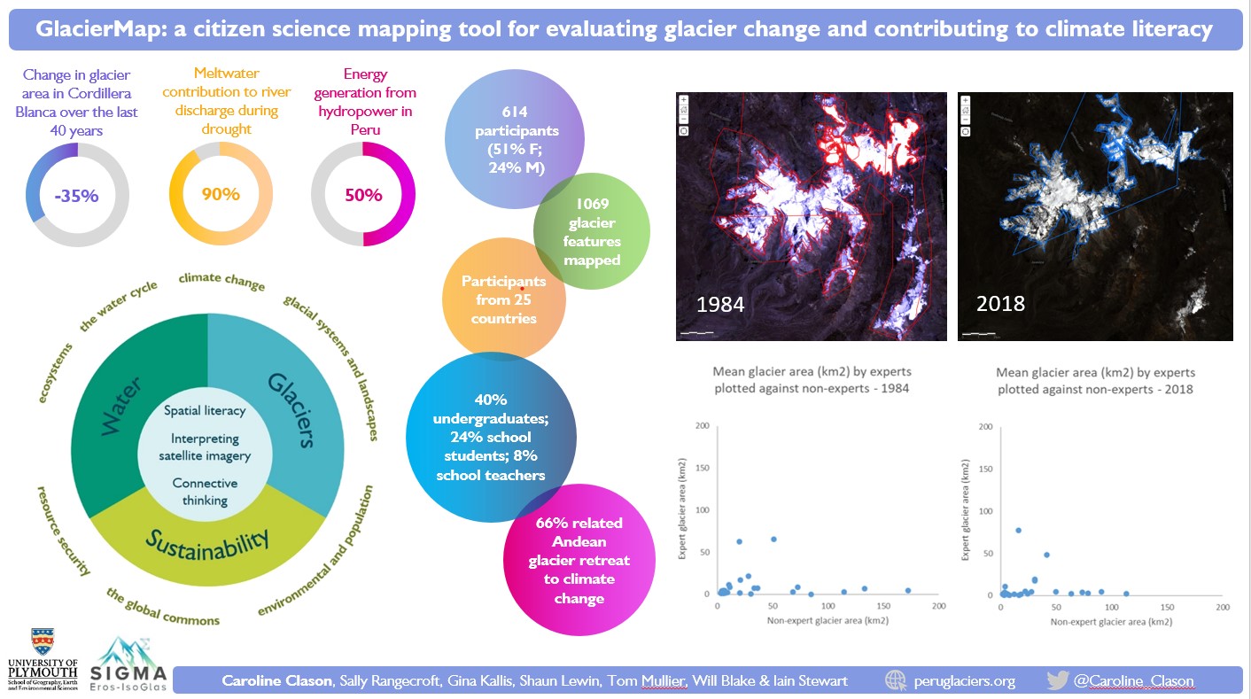
I’ll be presenting our work on the GlacierMap citizen science project today at EGU 2021. GlacierMap is a free, online mapping tool for contributing to both data collection and climate literacy through participant mapping of glacier change in the Peruvian Andes from satellite imagery. In the interests of accessibility for those who aren’t registered for EGU (and in case of any technical glitches!!) – you can find out more about the project HERE.